

Indonesia’s Anak Krakatau Volcano Erupts Again

Our dynamic planet continuously shifts through powerful geological forces that reshape surface landforms and impact human civilization. Active volcanic arcs across the globe regularly release accumulated subterranean pressures into the atmosphere. These sudden geophysical events produce dangerous environmental hazards while offering atmospheric scientists unique opportunities to study real-time volcanic dynamics. Indonesia’s Anak Krakatau Volcano Erupts Again
Read More: Why Indonesia’s Peatland Fires Are Burning Underground?
The Rise of a Hazardous Island Volcano
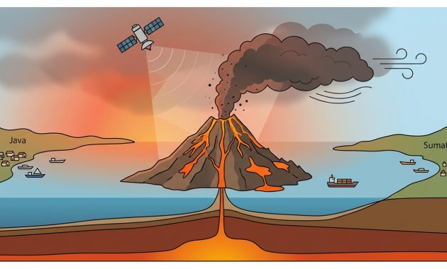
Situated within Indonesia’s Sunda Strait between Java and Sumatra, Anak Krakatau stands as a notoriously active volcanic island. The volcano emerged above sea level in the late 1920s from the caldera left by the historic 1883 eruption. Because of its strategic location near heavily populated coastal cities and busy maritime trade routes, volcanic activity from this peak frequently threatens local communities and critical transport infrastructure.
Eruption Mechanics and Atmospheric Dispersion
On September 9, 2026, satellite instruments recorded a powerful explosive eruption launching thick plumes of volcanic ash into the sky. High-altitude winds rapidly dispersed the dense particulate cloud across neighboring airspace and surrounding oceanic waters. This dramatic atmospheric injection created significant operational hazards for commercial aviation routes, causing widespread flight cancellations and severe regional travel delays.
Timeline, Research Team, and Observation Facilities
NASA Earth Observatory researchers, monitored by Responsible Official Diana Logreira, documented the ongoing event using real-time satellite telemetry. Spaceborne instruments captured detailed multispectral images of the eruptive plume on September 9, 2026. Earth observation specialists analyzed the atmospheric spread of airborne particles using operational data feeds maintained by NASA’s Earth Science Division.
Research Methodology and Monitoring Framework
Scientists employed advanced remote sensing techniques to evaluate the eruption’s severity and track the trajectory of airborne volcanic ash.
- Multispectral Imaging Sensors: Research teams utilized spaceborne radiometric sensors to detect thermal signatures and map ash plume boundaries.
- Atmospheric Plume Tracking: Specialists processed satellite data through automated algorithms to estimate plume altitude and particle density.
- Aviation Safety Integration: Orbital observations provided real-time volcanic ash advisory data to regional aviation authorities and meteorologists.
Distinctive Features of the Volcanic Plume
The eruptive column exhibited unique physical and environmental traits that set it apart from routine degassing events.
- High Particulate Concentration: The ash column carried vast quantities of fine rock fragments and glass particles capable of damaging aircraft engines.
- Rapid Vertical Ascent: Explosive thermal expansion propelled the ash cloud swiftly into high-altitude flight corridors within hours.
- Air Quality Degradation: Ground-level particulate dispersal significantly reduced visibility and degraded breathing air quality across downwind coastal zones.
Broader Environmental and Societal Impacts
Beyond air traffic disruptions, airborne ash fallout poses immediate risks to marine ecosystems and surrounding terrestrial vegetation. Microscopic volcanic fragments lower ambient air quality, triggering health warnings for vulnerable coastal populations downwind. Furthermore, continuous explosive activity alters local topography and increases regional landslide risks along the volcano’s unstable marine flanks.
Research Conclusion
Indonesia’s Anak Krakatau Volcano Erupts Again. This study demonstrates that spaceborne remote sensing provides vital real-time intelligence for tracking sudden volcanic hazards and mitigating societal disruptions. Orbital satellite observations enable scientists to continuously monitor ash plume dispersion, protect international aviation safety, and assess environmental risks across remote island chains. Consequently, researchers emphasize that maintaining advanced satellite monitoring infrastructure remains essential for safeguarding coastal populations against recurring volcanic emergencies.